There are 17 Counties in Nevada – “The Silver State“
Also be sure to see my United States County Counting Page for the rest of the states.

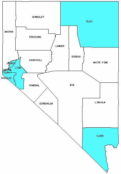
I have visited 6 Counties = 35.3% of Counties in Nevada
Counties visited are colored-in; counties still needing to be visited are blank. Map created using Mob Rule.
Twelve Mile Circle Articles Featuring Places in Nevada
Markers designate the Nevada locations featured in Twelve Mile Circle articles.
Counties in Nevada

Below are the 17 counties in Nevada. Although infrequent, counties sometimes do change so please let me know if any of this information is out of date and I will update it. Those counties that I have visited are highlighted in Red. Readers can also link to any articles manually in this section if the map isn’t working.
- Carson City (independent city)
- Churchill
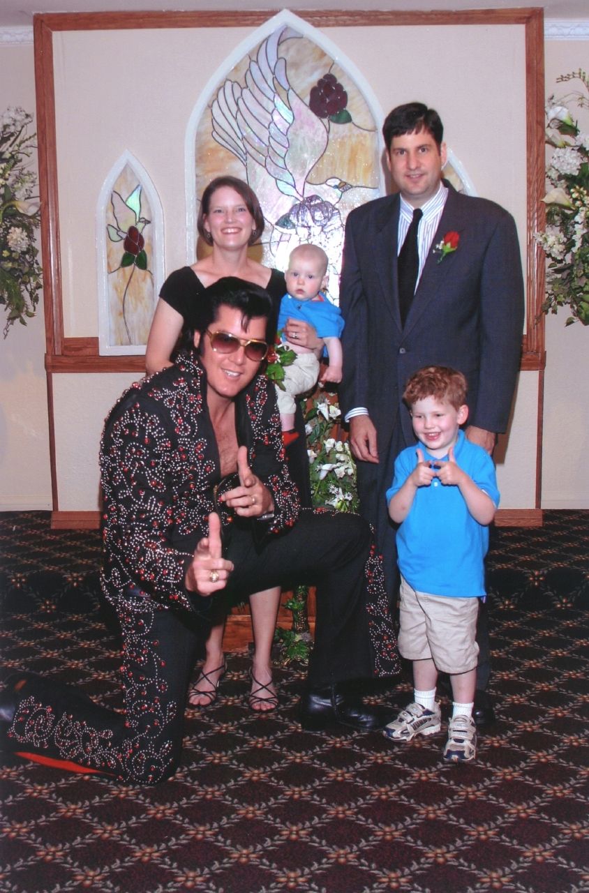
- Clark: Largest county population in Nevada (1,375,765 people in 2000 Census); Mt. Charleston; Bonnie & Clyde Death Car; History Vegas Style; The Simpsons House; 100th Meridian Initiative; Would You Believe?; Frank Sinatra’s Drive; The Cult of Elvis; Largest Artificial Lakes; Little Miss Muffet; Warp Drive; Temple of Goddess Spirituality Dedicated to Sekhmet; Gambling Banned in Nevada… in tiny pockets; Ellis Island Casino & Brewery; Elvis Wedding / Renewal of Vows; Holy Cow! Brewing Company; Tenaya Creek Restaurant & Brewery
- Douglas: Twelve Mile House; Right Up to the Line
- Elko: (West) Wendover: What Time? What State?; Right Up to the Line; Time Zone Limits; Orion Trail
- Esmeralda: Smallest county population in Nevada (971 people in 2000 Census); Something in Common; Highpoint, Not Summit
- Eureka: Loneliest Road in the USA
- Humboldt: Surrounded in Time
- Lander: Life is Hard
- Lincoln: Gambling Banned in Nevada!… (in tiny pockets)
- Lyon
- Mineral: Aurora: A County Seat in Two States. Simultaneously!; Digging for Minerals
- Nye: Largest county in Nevada (18,147 square miles); Solar System; Hot Springs Everywhere; State Centers of Population; Place Name Palindromes
- Pershing: From Camp to Town; Geography Ablaze
- Storey: Smallest county in Nevada (264 square miles); Virginia Silver and Gold; Cut the Corner
- Washoe: Thoughts on Los Angeles and Reno; Sports Facilities I Never Imagined; Trailer Park Nation; Fly Geyser; Revisiting the Most County Borders
- White Pine: Loneliest Highpoint; Flat as a Pancake
Quick Facts About Nevada
- Location: Mountain West United States. See map above.
- Size(1): 109,781 square miles. Nevada is the 7th largest state. The next larger state is Arizona and the next smaller state is Colorado.
- Population(2): 3,094,392 people. Nevada is the 32nd most populous state. The next more populous state is Iowa and the next less populous state is Arkansas.
- Population Density: 28.2 people per square mile. Nevada is the 42nd most densely populated state. The next more densely populated state is Kansas and the next less densely populated state is Nebraska.
- Bordering States: Nevada shares a border with 5 states: Idaho; Oregon; California; Arizona and Utah.
- Admission to the Union: October 31, 1864. Nevada was the 36th state admitted to the Union, after West Virginia and before Nebraska.
- Capital: Carson City.
- Highest Point: 13,140 feet at Boundary Peak. See SummitPost’s Boundary Peak page.
- Lowest Point: 479 feet at Mt. Manchester in Clark County.
- Government website: State of Nevada Official web site.
- Official Tourism website: Travel Nevada.com.
- Still not enough? See Wikipedia’s Nevada page.
Sources:
(1) Wikipedia: List of U.S. states and territories by area. Land area only.
(2) Wikipedia: List of states and territories of the United States by population. Estimated population on July 1, 2019.

Leave a Reply