After awhile experienced 12MC readers can sort-of guess where things are heading. I knew I ran that risk in the recent Blue Earth article. The early draft began to climb towards a thousand words and I still wanted to cover several more topics. Strategically, I split the article into two separate parts and wondered if anyone might call me out in the meantime. Sure enough, astute reader David Burrow commented that “Blue Earth is ‘famous’ locally for two things” (spoiler alert!). Well played, Mr. Burrow.
Indeed, the City of Blue Earth is well-known for two specific items that fit beautifully within the stated purpose of Twelve Mile Circle. The County of Blue Earth was also notable. I’ll discuss both the city and the county so maybe I’ll cover new material in there somewhere.
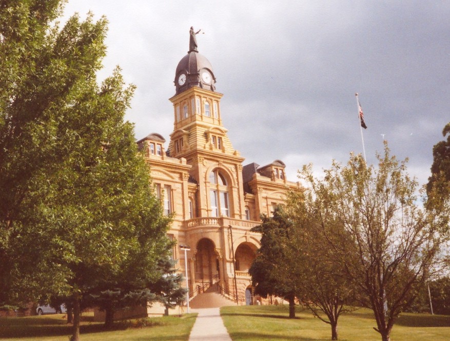
To recap briefly, Minnesota had both a city and a county named Blue Earth. However, the city wasn’t located in the county. The city of Blue Earth was the seat of government in Faribault County. Mankato, an anglicized version of a Dakota Sioux phrase translating to Blue Earth, was the seat of government in neighboring Blue Earth County. That should clear things up.
City of Blue Earth
AA Roads’ Interstate Guide mentioned several Interstate 90 superlatives, most notably its impressive length, 3,020.54 miles (4,861.09 kilometres), or “approximately 3,100 miles if shared alignment with I-94 in Wisconsin is included“. That made I-90 the longest segment of the entire Eisenhower Interstate System. It spans all the way between Seattle and Boston along the full width of the northern tier of the United States. Sometimes that exalted status elicited odd behavior. The residents of Wallace, Idaho, for example, declared the Center of the Universe to be next to “one of the last sections of Interstate 90 to open to through traffic.”
However Wallace’s segment was a bit of an anomaly. It marked not so much the completion of the route as much as the elimination of its final stoplight. Highway officials considered a segment outside of Blue Earth as the official completion point in 1978. That’s where construction crews paving towards each other from opposite directions finally met. If that sounded a bit reminiscent of the transcontinental railroad story from 1869 (my visit), the same thought occurred to people building this longest transcontinental interstate highway a century later.
The Golden Stripe
Naturally, government officials celebrated the completion of Interstate 90. They placed golden concrete slabs across the separate eastbound and westbound lanes. This “Golden Stripe” invoking the famous Golden Spike of yore, was accessible from rest areas on either side of the highway.
Nothing lasts forever, however, not even something as awesome as a golden stripe. Road crews paved over the stripes as part of a highway maintenance project several years later. They painted golden marks along the shoulders at the original points (Street View: eastbound and westbound) to commemorate the earlier stripe. So at least we still have those to remember the completion of the highway. A close-up photograph also appears on Roadside America.
Green Giant

The Green Giant brand of frozen and canned vegetables traced its origin to southern Minnesota. The “Valley of the Jolly Green Giant” referred to the nearby Minnesota River Valley. It began as the Minnesota Valley Canning Company in 1903, based in Le Sueur. A century later it still exists as an operating division within General Mills.
Blue Earth commissioned a replica of the Jolly Green Giant in suitable gargantuan proportions in 1979. Then they placed it along a highway on the edge of town. The Intertubes said it attracted over 10,000 visitors per year although I never found a citation. Approximately twenty-seven visitors per day? Yes, that sounded reasonable, maybe even a little low.
The city certainly loved its colors: BLUE Earth, GOLDen Stripe and GREEN Giant!
County of Blue Earth

More than half of Blue Earth County’s residents lived in Mankato (map) so I focused a 12MC lens on that particular spot. As the City of Mankato explained [link no longer works],
“Mankato also marked the southern and western edge of the ‘Big Woods’ (from the French ‘Grand Bois’), an enormous area of mainly deciduous forest that covered much of central to southeastern Minnesota.”
Little House
That triggered an ancient memory buried deep within my brain. Wasn’t Mankato one of those places mentioned in Laura Ingalls Wilder’s Little House series? Why, yes it was: “Mankato is a town in southern Minnesota where Charles Ingalls often had to make deliveries to. It is larger than Walnut Grove, a very bustling city“. Except Mankato appeared in “Little House on the Prairie,” not “Little House in the Big Woods”. In Little House world, the Big Woods was Pepin, Wisconsin (12MC drove through Pepin). It’s all so confusing. Mankato did serve as the site of LauraPalooza though. Those Wilder fans sure know how to get wilder.
Troubling History
However, Mankato probably registered for something much more disturbing.

The United States Army hanged 38 Dakota warriors in Mankato along the Minnesota River in 1862. This remains the largest mass execution in U.S. history, to this day.
Treaty payments due to Dakota Sioux were late again. This was yet another indignity in a long string of broken promises by the U.S. government. They’d already pushed the Sioux from much of their traditional hunting and agricultural grounds. Now, new arrivals from the eastern U.S. and Europe logged and plowed the landscape. The Dakota faced starvation after a crop failure and local traders refused to extend them credit. So the drought and grievances combined to spark the US-Dakota War of 1862 or the Sioux Uprising.
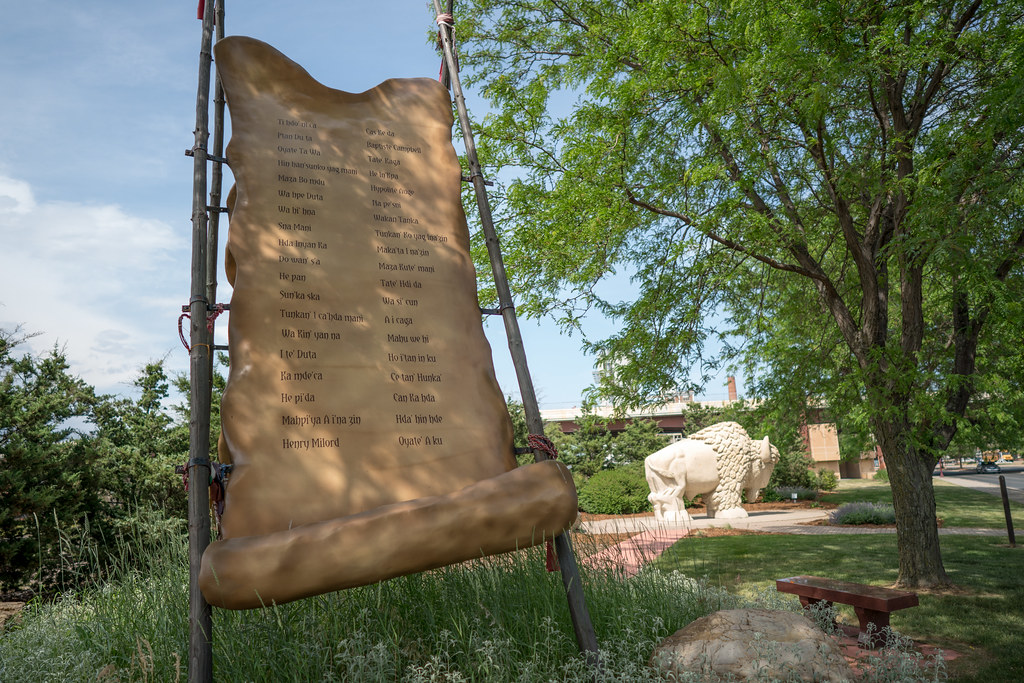
The city dedicated Reconciliation Park in the 1990’s on a small triangle of grass, hemmed-in by two busy roads and a set of railroad tracks, at the approximate location of the executions (map). Officials placed a bison statue there in 2012 — the sesquicentennial of the troubling events — and dedicated the Dakota 38 Memorial. It preserved the memory of those hanged after hasty trials and minimal opportunity to defend themselves against charges.
Completely Unrelated
I ran across an interesting premise for a blog while researching Blue Earth County, a site called Every County. A county-counter who realized he couldn’t visit every single county in person writes it. As the author stated, “it’s as a computer-chair traveler that I will try to visit every county in as many states as I can.” The site went live in 2012. I can’t believe I hadn’t discovered it earlier.

Leave a Reply