Time Zone crossings in the United States generally happen at state borders which of course are easily recognizable landmarks. So you simply cross the state line and you change your watch. No big deal. Unfortunately Time Zones cut right through the middle of some states, like Kentucky. That can be a real inconvenience if you need to be somewhere at a specific time.
Let’s make this really simple. If you’re driving on Kentucky’s Cumberland Parkway the changeover between Eastern and Central Time takes place between Mile Markers 72 and 73.
- If you’re driving westbound, going from Eastern Time into Central Time, set your coordinates to: 37.087626°, -84.906872°
- If you’re driving eastbound, going from Central Time into Eastern Time, set your coordinates to: 37.087448°, -84.906864°
Now you have all of the information you need. You can stop scrolling and move on with your day. Have a great trip!
But Wait, There’s More
Alright, all of the casual readers just left the room. Now we can get into some further detail that maybe 1% of you care about.
So why did Kentucky get split between Eastern and Central Time? It’s due to the interplay between geography and commerce. First, Kentucky sits just beyond the eastern seaboard states and then it extends for another 400 miles further west. It makes sense that time recognition would need to adjust to that vast distance.
Likewise, Kentucky doesn’t have a central urban area large enough to anchor the entire state within a single time zone. Louisville sits along the norther border and falls within the orbit of Cincinnati and Indianapolis, both located in Eastern Time. Similarly, western parts of the state feel the tug of Nashville and Memphis in Central Time. The conditions are ripe for a time split right through Kentucky. And that’s exactly what we see happening here, following a jagged line defined by county borders.
Westbound (going from Eastern to Central Time)

Cumberland Parkway (officially the “Louie B. Nunn Cumberland Parkway“) is a major east-west highway cutting through central Kentucky. It stretches 88 miles between Somerset and Park City (map). Once it was a toll road but that ended a couple of decades ago when the state collected enough tolls to pay off construction bonds.
Technically the Cumberland Parkway is not an Interstate Highway although it’s built to the same standards for most of its length. Someday it may become Interstate 365 after the completion of various improvements but that hasn’t occurred as of the time of publication.
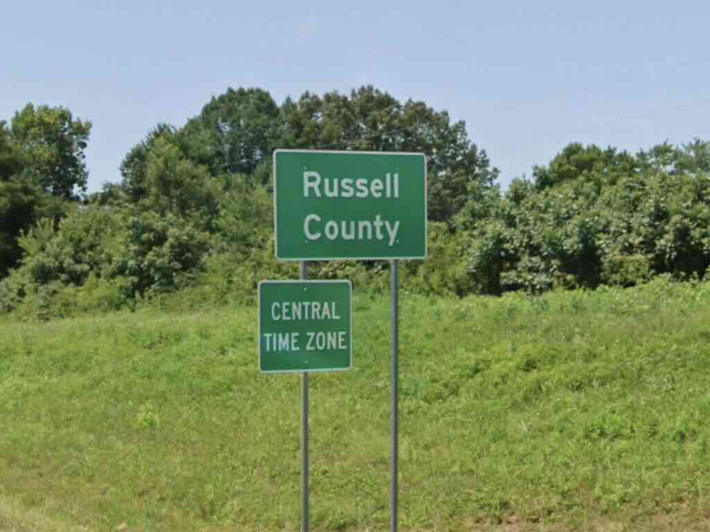
It also happens to straddle the “fault line” between different time zones where Russel County and Pulaski County connect. So, traveling west, drivers enter Central Time when they hit the Russel County line as signage makes abundantly clear. I took this exact route when I drove to Mammoth Cave National Park a few years ago.
Eastbound (going from Central to Eastern Time)

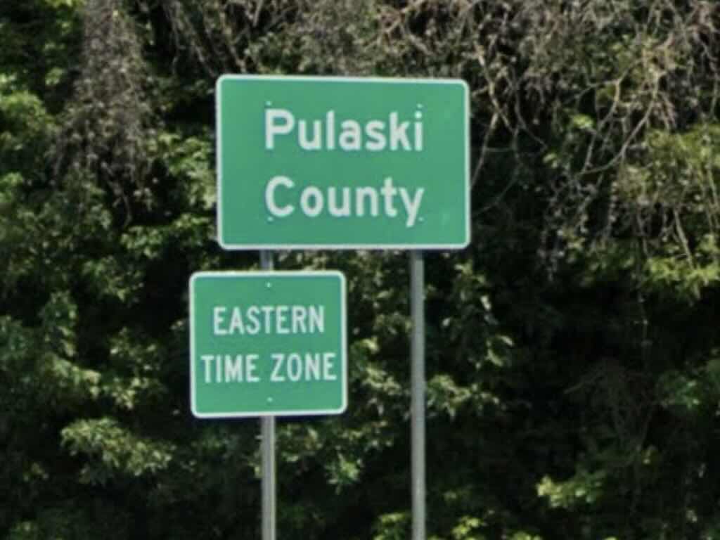
It’s not much different heading towards the east. However this time the change happens as a driver enters Pulaski County. That’s the point where motorists should change their watches or dashboard clocks. Mobile phones will eventually figure it out but sometimes it’s good to know the exact spot.
I’m pretty sure I’ve never driven Cumberland Parkway heading eastbound. Instead there’s a different place in central Kentucky where someone can drive due east into Central Time and vice versa, which is backwards. That’s due to a quirk in the layout of county borders and a fun diversion from the usual high speed highways. But maybe only I enjoy that kind of geographic weirdness.

Leave a Reply