There are 44 Counties in Idaho – “The Gem State“
Also be sure to see my United States County Counting Page for the rest of the states.

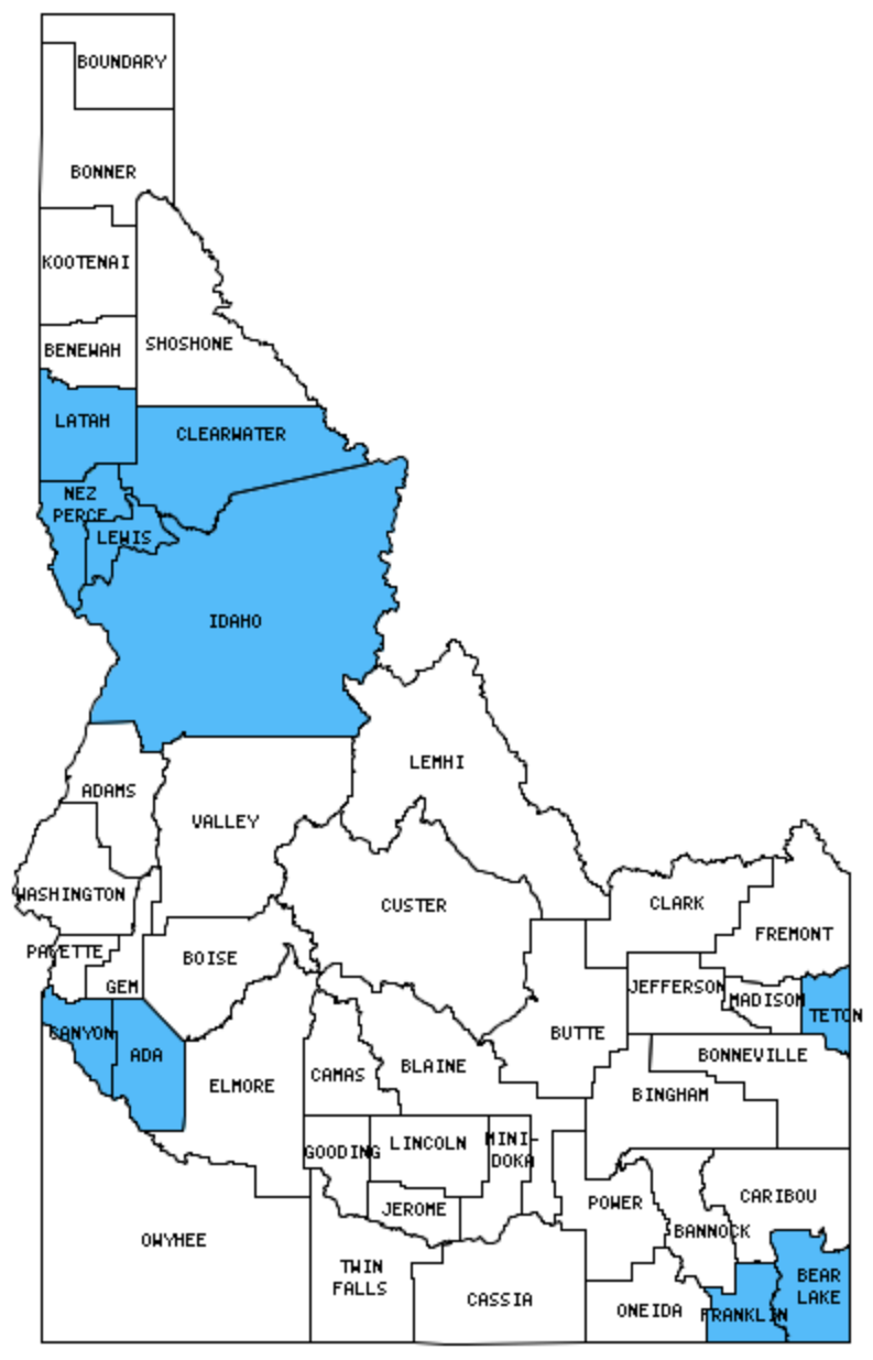
I have visited 10 Counties = 22.7% of Counties in Idaho
Counties visited are colored-in; counties still needing to be visited are blank. Map created using Mob Rule.
Twelve Mile Circle Articles Featuring Places in Idaho
Markers designate the Idaho locations featured in Twelve Mile Circle articles.
Counties in Idaho

Below are the 44 counties in Idaho. Although infrequent, counties sometimes do change so please let me know if any of this information is out of date and I will update it. Those counties that I have visited are highlighted in Red. Readers can also link to any articles manually in this section if the map isn’t working.
- Ada: Largest county population in Idaho (300,904 people in 2000 Census); Star Garnet Brewing; Table Rock Brewpub; What’s the Meridian?
- Adams: Brundage Mountain ski resort
- Bannock
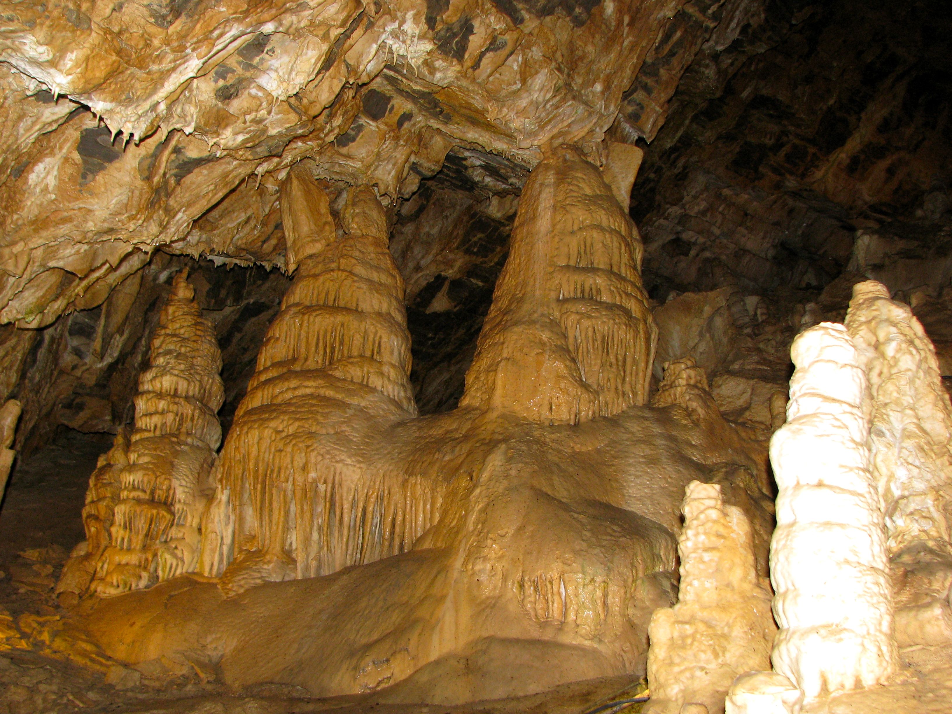
- Bear Lake: Minnetonka Cave
- Benewah
- Bingham
- Blaine
- Boise: Bogus; Horseshoe Bend
- Bonner: Oldtown
- Bonneville
- Boundary
- Butte
- Camas: Smallest county population in Idaho (991 people in 2000 Census).
- Canyon
- Caribou
- Cassia: Rise and Fall of Idahome
- Clark
- Clearwater: Lewis and Clark’s Canoe Camp
- Custer
- Elmore: Sawtooth Elsewhere; Mountainous Claims
- Franklin
- Fremont: Going Postal
- Gem
- Gooding
- Idaho: Largest county in Idaho (8,485 square miles); Camas Prairie; USA Time Zone Anomalies, Part I
- Jefferson
- Jerome
- Kootenai: That Recurring State Line
- Latah: Univ. of Idaho Arboretum; Three American Moscows; What State U
- Lemhi
- Lewis: Camas Prairie Railroad Trestle
- Lincoln
- Madison: Highest Religious Affiliation
- Minidoka
- Nez Perce: Clearwater River Railroad Bridge; Farthest Inland Port; Hells Gate State Recreation Area; Lewis and Clark Center; Lewiston; Lewiston Hill Overlook; Lewiston–Nez Perce County Airport; Locomotive Park; Nez Perce National Historical Park
- Oneida
- Owyhee
- Payette: Smallest county in Idaho (408 square miles).
- Power
- Shoshone: The Center of the Universe; The Last Stoplight on Interstate 90; No-see-um Lake; Wallace Redux
- Teton: Adjacent Counties, Same Name, Different States
- Twin Falls
- Valley
- Washington
Quick Facts About Idaho
- Location: Mountain West United States. See map above.
- Size(1): 82,643 square miles. Idaho is the 11th largest state. The next larger state is Oregon and the next smaller state is Utah.
- Population(2): 1,793,208 people. Idaho is the 38th most populous state. The next more populous state is Nebraska and the next less populous state is West Virginia.
- Population Density: 21.7 people per square mile. Idaho is the 44th most densely populated state. The next more densely populated state is Nebraska and the next less densely populated state is New Mexico.
- Bordering States: Idaho shares a border with 6 states: Washington, Oregon, Nevada, Utah, Wyoming and Montana. It also shares a border with Canada.
- Admission to the Union: July 3, 1890. Idaho was the 43rd state admitted to the Union, after Washington and before Wyoming.
- Capital: Boise.
- Highest Point: 12,662 feet at Borah Peak. See SummitPost’s Borah Peak page.
- Lowest Point: 710 feet at the Snake River in Nez Perce County.
- Government website: Idaho.gov – The official website of the State of Idaho .
- Official Tourism website: Visit Idaho.
- Still not enough? See Wikipedia’s Idaho page.
Sources:
(1) Wikipedia: List of U.S. states and territories by area. Land area only.
(2) Wikipedia: List of states and territories of the United States by population. Estimated population on July 1, 2019.

Leave a Reply