Every schoolchild in the United States learned about the Cumberland Gap during history class. The Appalachian Mountains formed a natural barrier to western expansion during the colonial era. Even so, the lower section contained a convenient gap. Native Americans knew about it for centuries before Europeans ever arrived.
Dr. Thomas Walker, a Virginia physician and explorer, recorded the gap in 1750. Then he brought it to the attention of other colonists. A quarter century later, Daniel Boone widened the trail through the gap as a key element of the Wilderness Road. Settlers streamed through the passageway and into the Ohio Valley by the tens of thousands during the earliest years of the newly-formed United States.
That geographic and historical artifact captured my imagination a long time ago. I kept it on my visit wish list for many years and finally the opportunity arose.
Inspiration and Opportunity
The Weekend Roady gave added incentive in So Close, Yet So Remote (Lee County, VA) a couple of year ago. He flagged a particular local geo-oddity at the trailhead:
“At the very end is a parking lot – situated, yes, in Virginia territory! This little lot represents the furthest west you can drive a car around in Virginia (so, of course, I had to take a photo of my car parked there – at that moment I was the westernmost vehicle in Virginia – that’s ‘geekspeak’ for cool.)”

So I drove my car from our hotel in Middlesboro, Kentucky a couple of miles to the Cumberland Gap Tunnel where I entered Tennessee, then a couple more miles to the outskirts of the town of Cumberland Gap where I clipped the Virginia border, then back into Tennessee through the town proper, and finally into the same parking lot mentioned by Weekend Roady on the Virginia side of the boundary. That’s how the day went, crossing state lines frequently and unexpectedly.
We planned to hike 1.2 miles (1.9 kilometres) from the trailhead at Virginia’s westernmost parking lot to the Kentucky-Tennessee-Virginia (KYTNVA) Tripoint, and then back down.
Iron Furnace

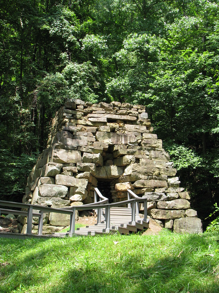
The first leg, the Tennessee Road Trail (aka Iron Furnace Trail) lasted 0.3 miles (0.5 km), with the first trail segment paved in asphalt and easily accessible. Naturally it led to an Iron Furnace.
Signage indicated that an iron smelting complex known as the Newlee Iron Furnace operated here from the 1820’s to the 1880’s, using a nearby creek and a waterwheel as its power source. Only the furnace structure remained and it was quite large. Several people could walk into the ruins and stand inside of it simultaneously.
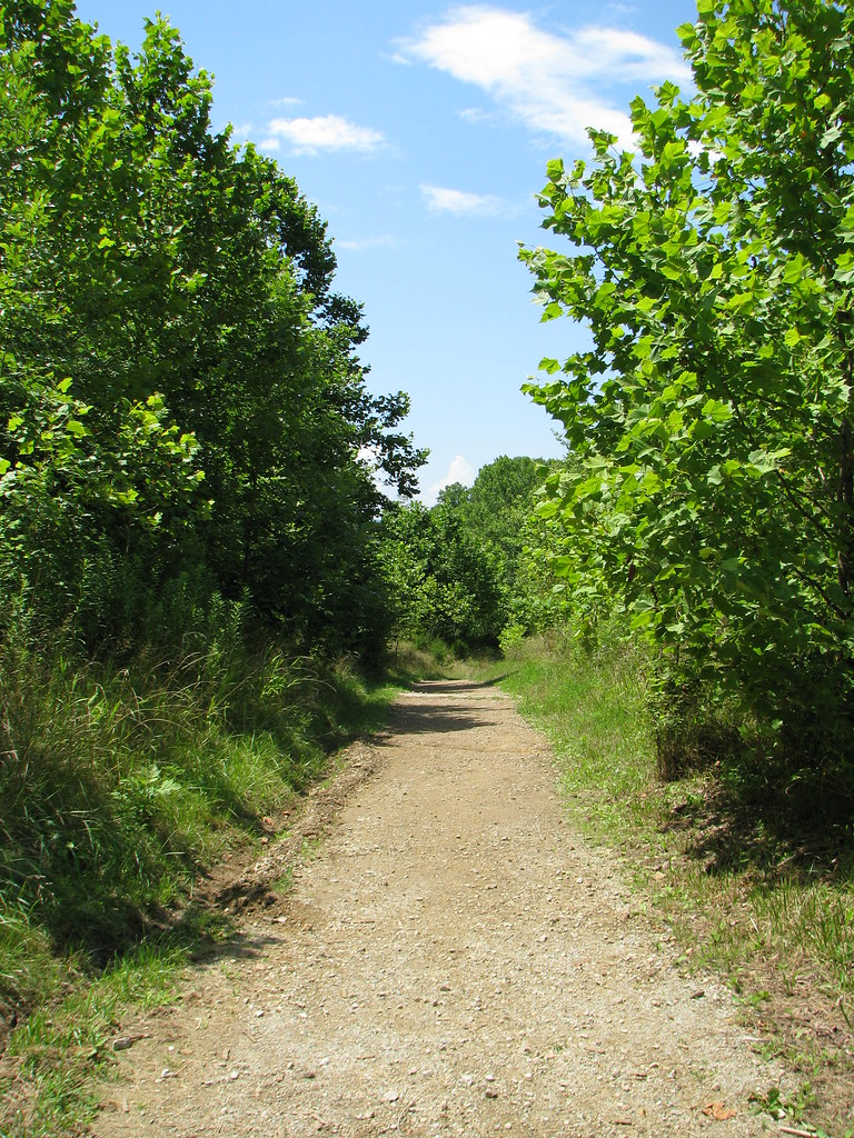
From there, the Tennessee Road Trail left pavement, doglegged once, and then joined the Wilderness Road Trail at a T. We turned left at the T and continued uphill.
Saddle of the Gap

The Wilderness Road Trail followed the same pathway used more than two centuries ago by Daniel Boone and the early Kentucky settlers. We had it pretty easy compared to the pioneers as we traveled in their footsteps for only another 0.3 miles (0.5 km). We approached the “Saddle of the Gap,” and crossed back into Kentucky. This was THE SPOT, a place of stunning historical significance, the point where thousands of people left the eastern side of the settled continent and entered into a wild frontier.
It may seem underwhelming on first glance. Here, at this amazingly important point of geography, one could hardly distinguish the Saddle from any other random trail. One should understand that this was an intentional design.
An automobile road once cut through here. Old U.S. 25E linked Cumberland Gap, TN to Middlesboro, KY using the gap; and the gash it created still appears in satellite images. However, the Cumberland Gap Tunnel replaced the road in 1996. The National Park Service removed asphalt, obscured the roadbed and continues to restore the Cumberland Gap to its original Wilderness Road appearance. Forest will completely obscure the gash within a few decades and the restoration process will finally end.
Saddle Marker

One artifact of the old road remained, a large marker placed in commemoration of Daniel Boone and the early pioneers by the Daughters of the American Revolution in 1915. Until 1996 it would have been located just south of the paved road heading over the mountaintop and an easy pull-off for motorists. Today only hikers can reach it.
We encountered the marker at the Saddle on a side-trail found to the left as one walked up the Wilderness Road Trail from Virginia into Kentucky. That was a convenient waypoint. It marked the start of the Tri-State Peak Trail and the halfway point of our excursion. It also provided a nice place to stop and rehydrate on a typically hot, humid mid-Summer day in the Appalachians.
State Tripoint

The final leg stretched from the DAR’s Daniel Boone marker to the top of Tri-State Peak, a distance of 0.6 miles (0.9 km). It passed the long-ago remnants of a Civil War fortification. Union and Confederate troops traded control of the Gap throughout the war, hauling cannons and supplies to various mountaintops. However, no major battles took place there. We didn’t stop to poke around though. Our goal was the summit.
The trail went through a long switchback and climbed to the crest, where it crossed back into Virginia. Then it pushed upwards to the peak and a pavilion that marked the KYTNVA tripoint. Each state had its own plaque. Lines marked state boundaries. We stopped for a snack and posed for the obligatory photos of each of us standing in three states simultaneously. That’s what happens on a geo-geek vacation.
It was one of the more nicely marked tripoints I’ve seen.
Summary of the Hike
- Trailhead: Parking lot on VA side of the border at the very end of Pennlyn Ave., in Cumberland Gap, Tennessee.
- Tennessee Road Trail (0.3 miles): Asphalt to Iron Furnace then unpaved trail to T intersection with Wilderness Road Trail; turn left onto Wilderness Road Trail.
- Wilderness Road Trail (0.3 miles): Hike up to the Saddle of the Gap, then turn left at the sign for Tri-State Peak (Daniel Boone marker will be clearly visible).
- Tri-State Peak Trail (0.6 miles): pass the Daniel Boone marker, pass the remnants of the Civil War fort; switchback, and continue uphill to the Tripoint.
This was a pretty easy hike even though the entire route climbed uphill. The trails were well marked, they were in good shape, and it never got too rocky or too steep. There were also plenty of historical features spaced appropriately to break up the walk, and hold the attention of our kids.
I’d recommend this short hike for anyone interested in geography or history.

Leave a Reply