Longest Natural Straight Line

I once featured a stretch of completely straight railroad track across the Nullarbor Plain. It ran an amazing 478 kilometres (297 miles), in Australia’s Longest Straight Line. I’ve also focused considerable attention on the Canada-United States border. That one hugs the 49th degree of latitude north for something like 2,000 km (1,250 mi) — although we know it’s really composed of hundreds of smaller segments. However, these very long, very straight lines come from the minds and hands of humans. What is the longest line on earth, I wondered, created completely by nature?

Let’s temper our expectations. Long straight lines don’t come easy in nature. Certainly, like the monkeys typing Shakespeare, it can happen. But I’m not searching for exactness. Approximately straight or straight-ish is good enough for me. Also, I’m also not the first person to ponder this question by any means. The Intertubes are full of different sites and forums where people ponder similar mysteries.


Local Geological Formation?
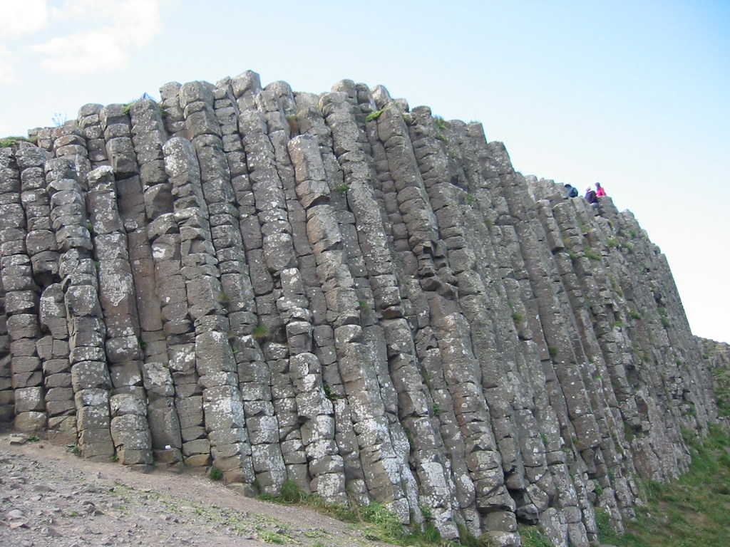
Giants Causeway. Photo by Garrett Coakley; (CC BY-NC 2.0)

Lots of people see straight lines in local landmarks, often in the form of columnar basalt. This is an extrusive volcanic rock that forms as magma pushes to the surface. Impressive results appear throughout the world in many different locations.

The most well-known instance is quite possibly the Giant’s Causeway in County Antrim, in Northern Ireland (map). Now consider the image above and notice the people standing atop the formation. That will give an indication of scale. The stones align in a fairly straight set, albeit a little jagged along the edges.

But we can do better.


Waterfall?

Angel Falls. Photo by Carten ten Brink; (CC BY-NC-ND 2.0)

With a waterfall, the notion focuses on a continuous stream of water propelled by gravity. Thus it forms a more-or-less straight line as it cascades towards the ground below.

So the longest straight line, assuming one accepts that premise, equates to the longest single-drop segment of waterfall that exists. That happens at Kerepakupai Merú in Bolívar, Venezuela (map). There a single segment falls 807 meters / 2,648 feet (of total height of 979 m / 3,212 ft). As the World Waterfall Database describes it,

“Kerepakupai Merú, or Parekupa-vena are the proper names given to Angel Falls by the indigenous Pemon Indians… the falls funnel into a sinkhole at the edge of the mountain and burst forth from the side of the cliff about 100 feet from its top, plunging a sheer 2,648 feet into the massive canyon below and forming the tallest uninterrupted waterfall on earth.”

One only needs to examine a photograph of Kerepakupai Merú or just about any other waterfall to notice a fallacy in the claim. Many factors affect the trajectory of the stream. These include currents at the top of the cliff, rocks protruding at the spout, and winds along the face of the cliff. I have no doubt that individual droplets follow a more-or-less straight line. However, I’m not sure I’d describe an entire waterfall as a single entity in this manner.


Fault line?
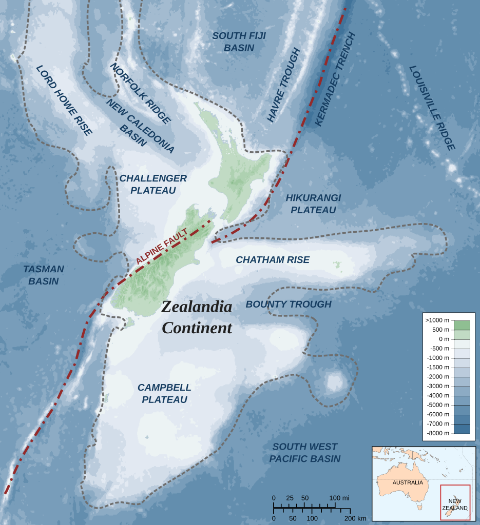
Zealandia-Continent map en. Alexrk, CC BY-SA 3.0, via Wikimedia Commons

This possibility holds more promise. Perhaps earthquakes, volcanoes or plate tectonics could scar the surface of the earth in a generally linear fashion. Some speculate that the Alpine Fault in New Zealand might fit that definition at over 500 km (300 mi). However, I have to doubt the accuracy of that claim. I couldn’t find any scientific source to confirmed it.

That doesn’t matter. Another example completely dwarfs it.

The Indian Ocean hides a feature known as the Ninety East Ridge or the Ninety Degree Ridge. This is a rather descriptive name. As it implies, the ridge aligns very closely with the 90th degree of longitude east. The feature stretches approximately 5,000 km (3,100 mi). The Public Broadcasting Service calls it “the longest, natural, straight-line feature on the planet (both on land or in the sea).”

Ocean Island Tholeiites, a type of basalt, formed Ninety East Ridge. Wikipedia notes that the “… age progression has led geologists to theorize that a hotspot in the mantle beneath the Indo-Australian Plate created the ridge as the plate has moved northward in the late Mesozoic and Cenozoic. “

Well, I’m not sure I’m any closer to finding the longest natural straight line on earth. It’s rather subjective and depends upon one’s tolerance for “straight”. If fuzzy is acceptable then Ninety East Ridge might be the best terrestrial example.

Comments

5 responses to “Longest Natural Straight Line”

  1. Pfly Avatar
    Pfly

    My first thought was the chain of islands and seamounts made by the Hawaiian hotspot. It runs nearly straight (more or less) from the Hawaiian Islands WNW for about 2,300 miles. After that the angle shifts abruptly to almost due north, continuing in another straight line (more or less) for about 1,300 miles. It’s pretty striking on an ocean floor map like http://en.wikipedia.org/wiki/File:Hawaii_hotspot.jpg. And that angle change in the middle makes my head spin trying to picture how the Pacific plate changed *it’s* angle of movement while the hot spot remained stationary underneath. Still, your Ninety East Ridge is long than either of the straight-ish Hawaiian hotspot segments, and looks straighter.

    Panning around Google Earth, it looks like there may be longer straight features of the ocean floor–mostly smaller trenches/faults/cracks/whatever they are. Some might be artifacts of data collection, I’m not sure. Some are “fracture zones”, perpendicular to the mid-ocean ridges. I dunno, some long, straight-looking ones are named on this map: http://www.freeworldmaps.net/ocean/pacific/index.html

  2. Rhodent Avatar
    Rhodent

    Two questions come to mind: 1. Does the line have to be visible? 2. Does “on earth” mean on the surface of the earth? I ask because to my mind, the Earth’s axis of rotation is an easily-definable line (if an invisible one that exists inside the earth rather than on its surface), and the fact that it is created by the earth’s rotation makes it “created by nature”. I realize that it’s not a particularly satisfying answer, though.

    For a potentially more satisfying answer, some of the fracture zones in the Pacific Ocean create some lines that rival the Ninety East Ridge in terms of straightness, and may be longer (it’s hard to tell because I’m stuck looking at Google Maps right now, and the Mercator projection makes it hard to compare distances). In particular I’m thinking that the Chipperton Fracture Zone line, which runs from Kiribati to a point roughly where due west of Nicaragua and due south of the top of Baja California, might qualify.

    1. Rhodent Avatar
      Rhodent

      Er…make that “due south of the TIP of Baja California”…

  3. AndyH Avatar
    AndyH

    What is the longest continuous stretch of seawater in the world? ie What is the furthest distance that one could sail around the globe in an exactly straight line without hitting any land?

    I reckon if you start just north of Japan and head roughly South-East, sailing in a straight line “underneath” South America then you might actually end up getting all the way back to Asia.

    If u manage to miss Madagascar, and India, then you will end up hitting West coast of Thailand…It looks on my globe as though it might just be possible, in which case I reckon that would be a 20,0000 mile straight line sea journey. Can anybody confirm ? It has to be a completely straight line in order to count!

    1. abc Avatar
      abc

      Saw this question and wasted WAY too much time playing with it. I don’t have a scientific way to address this, but here are a couple of possible solutions:

      1) Longest, but not perfect

      Start at Dakar, Senegal, and draw a circle heading at 155.55 degrees. Apart from a few minor deviations, the circle will lie on about 22000 miles of ocean, starting in north Hudson Bay, go through the north Atlantic, across just nipping West Africa, again just nipping the coast of Antarctica, bump into Tasmania and a bit of Australia, then clear ocean back to the Gulf of Alaska.

      2) Clean, pretty long

      Start at Nuka Island, Alaska, heading about 132.5 degrees. You pass off the western coasts of North and South America, pass through Straight of Magellan (skirting the coasts of South America and Antarctica, open ocean to the Maldives, then hit land on the southern tip of India. This is about 17500 miles of ocean.

      3) Probably the best answer

      Maybe the most likely, start at about 58.8N 162.8e, heading about 108 degrees. Cross the Pacific, pass through Straight of Magellan, thread the needle between Mozambique and Madagascar, running aground in Pakistan. This looks like about 19500 miles.

Leave a Reply

Your email address will not be published. Required fields are marked *

Latest Comments

  1. Does anyone have actual music to the song – Tanaha ,Timpson. Bobo and Blair ?? It was recorded by Tex…

  2. I am a grandchild of Jury and David Adams of BoBo Tx Shelby County we still have the family home…